The Fort du Questel
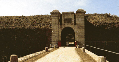
Vue du fort détaché du Questel : front de gorge, porte d'entrée monumentale à pont-levis. (c) Inventaire général, ADAGP, 2006. Source : http://patrimoine.region-bretagne.fr
This fort watches over the junction of the valleys of le Moulin du Buis where the enemy could set up camp in order to bombard Brest.
Richelieu, the founder of the Port du Ponant, launched the first work to fortify the town, which was then continued by Vauban under Louis XIV. It was during the reign of Louis XVI, during the American War of Independence (1775-1783), that the king, fearing that the English would land in Brittany, decided to construct forts and redoubts.
Constructed in various ways depending on the geography of the area to be defended, they all however possessed the means to cross their fire and respond to the intermediate batteries built on the first sign of war. These fortifications, evidence of the history of Brest and the surrounding area, were in their time considered to be state of the art French fortifications on the eve of the revolution. The Fort du Questel is in reality a "redoubt", in other words, a fortified, square-shaped construction, whose entrance or gorge is located on the least exposed side. This enormous quadrilateral with 100 metre long sides is situated between the Fort du Kéranroux (1.5 km t the right) and the Fort de Penfeld (1 km to the left).
Le Fort du Questel watches over the junction of the valleys of le Moulin du Buis, where the enemy could set up camp in order to bombard Brest. Surrounded by deep moats and accessible by a drawbridge, it consists of a stone wall (escarpe), with a walkway around the top for use by the musketeers. This walkway is itself surmounted by a rampart made of earth, which is set back and designed to support the artillery (26 canons in total, with a range of up to 4.5 km). The garrison of around 200 men there had access to various galleries, including two large underground ones linking the central courtyard with the walkways. We should also note the presence of rest areas which, during Vauban's time, was still a privilege ...
Constructed on a 6 hectare site Fort du Questel overlooks the Valley of the Allégoet, a tributary stream of the river Penfeld. Today, this site is one of a series of redeveloped natural areas leading up to the banks of the Penfeld along a circuit that passes by the foot of the Cavale Blanche hospital. On its premises, the fortress provides scenic walks through its well-sheltered ditches, basements, staircases, scarp and counterscarps, esplanade and its nearby cool undergrowth. The Fort du Questel has also become a popular place for hosting many activities.
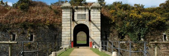
L'entrée du fort du Questel. Source : Communauté urbaine de Brest
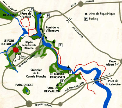
Plan de situation. Source : Communauté urbaine de Brest
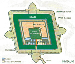
Le plan du fort. Source : Communauté urbaine de Brest
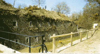
Un fossé du fort du Questel. Source : Communauté urbaine de Brest
Practical information
Chemin du Buis 29200
Brest
Accès libre