Newsletter

Fort des Mille-Fourches

Detail of the two caponniers of the Fort des Mille-Fourches. Source Fortweb.net

The fort des Mille-Fourches was constructed between 1887 and 1890. It operated in conjunction with the fort de la Forca, of which it is a copy. The Redoubt of les Trois Communes, built later, protects them both.

The fort des Mille-Fourches was constructed between 1887 and 1890. It operated in conjunction with the fort de la Forca, of which it is a copy. The Redoubt of les Trois Communes, built later, protects them both.

Its construction was brought about as a result of the Treaty of Turin of 1860. The Savoie and Nice had become part of France once more. The Valley of the Roya, a communications route running north to south in the heart of the Alpine mountain range, was shared between France and Italy. Sealing off the new border had thus become a strategic matter of utmost importance. The military defeat of 1870 forced the complete reorganisation of national defences: reforms within the system of command, the general staff and the armed services and the redefining of the military constituencies into eighteen military regions. All these initiatives were designed to help in preparing to reverse territorial losses and avenge the insult of losing the Alsace-Lorraine. The northeastern border was the subject of all the attention. However, General Seré de Rivières was aware of developments in Franco-Italian relations.
The redoubt of les Trois Communes, built later, protected them. It reflected the rise in tensions between France and Italy and technological developments in particular, such as the "torpedo shell crisis", which rendered some of the Séré de Rivières system obsolete. New projectiles came in the form of cylindrical warheads, which exploded in the open air, with steel replacing cast iron; the new mixes of explosives were more powerful and no longer created smoke; canons (Bange 155 mm and 220 mm) could fire further. Armour plating and surface stonework could therefore be pierced and obstacles on the ground (moats and parapets, caponniers etc.) shattered. The fort des Mille-Fourches belongs to the first generation of the Séré de Rivières system. A belt of forts, built upon natural obstacles at a distance of a few kilometres, provided a range of artillery cover to protect a town (or central nucleus) from 6 kilometres to the rear from enemy bombardment. Le Mille-Fourches is a small fort with a façade with very few openings. It is surrounded by a moat and flanked by concrete caponniers. The internal courtyard was replaced by a vaulted chamber.
With Mussolini's rise to power and the deterioration of Franco-Italian relations, the Authion became a fortified mountain range. The construction in 1929 of a cable car linking the road from Moulinet to Turini and the camp at Cabanes Vieilles made it easier to get supplies to troops all year round. As part of Maginot's programme, the forts of Plan Caval, Raus, la Béole and la Déa were under construction from 1933 onwards. The group was part of the fortified section of the Alpes-Maritimes département (secteur fortifié des Alpes-Maritimes or S.F.A.M.). On the 10th June 1940, Italy declared war on France (Mussolini was hoping to annex Nice and the Savoie). The Italian offensive took place from the 20th to the 25th June. On the 25th June, the armistice was signed. The Alpes-Maritimes was part of the free zone, with the exception of Menton and part of the towns of Isola and Fontan.
In 1942, following the allied landings in North Africa, the Alpes-Maritimes was occupied by the Italians. They were replaced by the Germans in 1943. After the allied landings of the 15th August 1944 at Dramont in the Var, most of the département was liberated on the 6th September, although the high valley of la Roya and the Authion mountain range were still occupied by the Germans who rebuilt the fortifications. General de Gaulle wanted Tende and La Brigue to become part of France again. He hoped to force the hands of the Allies who were quite hostile to any changes to the borders. So, in Nice on the 9th April 1945, he announced the offensive on the Authion and la Roya. Operation "Canard" (Duck) began on the 10th April. On the 12th April, the French took the Authion. French sovereignty over these former Italian territories was recognised by the Treaty of Paris.
Belvédère Tourist Information office: + 33 (0) 4 93 03 41 23 Saint-Martin de la Vésubie Tourist centre: + 33 (0) 4 93 03 21 28 Access The D 2566 via the Turini pass, towards the resort of Camp d'argent and then Authion. Car park in les Trois Communes On foot from les Trois Communes car park

> Return to results

Practical information

Address

6540
Saorge
04 93 03 21 28

Redoubt of 3 Communes

First fort in the Alps to be built of reinforced concrete, Redoubt of 3 Communes is part of the system for securing the countryside around Nice developed by Seré de Rivières.

The first fort in the Alps to be built of reinforced concrete, the Redoubt of Les Trois Communes is part of the system for securing the countryside around Nice developed by Seré de Rivières. Constructed in 1897 on the site of a former Sardinian battery, the Redoubt of Les Trois Communes occupies one of the Authion's strategic positions and controls the La Roya and Vésubie valley. It watches over the crest of the Ortiguié which leads to the Raus pass and the former border. It is the highest point in the Authion range at an altitude of 2080 metres.

The limestone valley of La Roya marks the easternmost edge of the Nice hinterland. Belonging first of all to Provence in the 13th century and then to the Savoie at the end of the 14th century, it is a transit zone for goods from the coast towards Piedmont. Controlled in turn by the Sardinians, Spanish, Austrians and French, in the 18th century it was the setting for many confrontations, most notably around Sospel, between Sardinian anti-revolutionary troops and republicans. The lower valley of La Roya became French during the reattachment of the county of Nice to France in 1860. The upper valley was retained by Italy, giving more weight to the strategic role of the forts. The aim of the redoubt was to protect two other forts built on the Authion: Forca and Mille Fourches. It thus played its part in securing the valley.
Small in size, built on high ground and surrounded by a moat, the fort was one of the first to be built from reinforced concrete at the end of the 19th century and the first fort in the Alpes-Maritimes to use both stone work and reinforced concrete. It was thus a "prototype" that demonstrates the development of fortification techniques. It is of note that, to save money, only the sides exposed to Italian fire were reinforced with concrete. During the construction of the Alps Maginot line, protection was provided by Fort Saint-Roch. Violent battles took place there in 1945. Preserved as it was, the fort bears witness to the violence of the fighting of April 1945 that allowed the 1st DFL to take back the Authion range from the Germans.
Tours from June to October Belvédère Tourist Information Office: +33 (0) 4 93 03 41 23 Saint-Martin de la Vésubie Tourist centre: +33 (0) 4 93 03 21 28 Access Via the col de Turini on the D 2566, towards the resort of Camp d'argent and then Authion. Car park in Les Trois Communes

> Return to results

Practical information

Address

6540
Saorge
04 93 03 21 28

Weekly opening hours

Le fort ne se visite pas

Eperlecques bunker

Eperlecques Bunker Source: http://www.leblockhaus.com/fr

The Eperlecques bunker, the biggest bunker in the North of France, a listed historical monument.

Built by the Germans (Organisation TODT) in 1943, the Eperlecques bunker was the first base for launching V2 missiles built in France.

At the same time, in the same forest, a V1 launchpad was under construction. It is 20 km from the coast, between Dunkirk, Calais, Boulogne and St-Omer.

From March to 27 August 1943, construction of the Eperlecques bunker was making good progress. On 27 August, the site was bombarded by the Allies. Work began again and the deported and prisoners began to arrive in November. The initial project was altered to install a liquid oxygen production plant (combustive fuel for V2).

Visitors walk around a park set out with diorama and military equipment, following a marked route with sound in several languages, as follows: A page in history

•         Comparison of V1 and V2;

•         Development of the Eperlecques bunker;

•         Construction of this concrete giant;

•         The bombings;

•         Modifications to plans after the bombings;

•         The result of an artificial earthquake.


Visitors then enter the building, where the visit continues. Inside the bunker, an audio-visual projection plunges visitors into cold and darkness.

On leaving the bunker, visitors listen to conclusions relating the past to modern day, such as the fact that the V2 was the ancestor of space conquest. The final message emphasises the necessity to work for peace.


Eperlecques Bunker
Rue du Sart 62910 Eperlecques
Tel.: +33 (0)3.21.88.44.22
Fax: +33 (0)3.21.88.44.84


Open in March from 11am to 5pm. In April and October from 10am to 6pm. In May, June, July, August and September from 10am to 7pm. In November from 2.15pm to 5pm.
 

Eperlecques Bunker


Quiz: Forts and citadels

> Return to results

Practical information

Address

Rue des Sarts 62910
Eperlecques
Tél : 03.21.88.44.22Fax : 03.21.88.44.84

Prices

Adulte: 9€ Enfant: 5€ Etudiant: 6€ ' En famille (2 adultes et 2 enfants ) : 25€ ' Groupe adultes de 10 à 30 personnes: 6€ Groupe adultes plus de 30 personne: 5,50€ Groupe scolaire: 4,50€ par enfant

Weekly opening hours

Ouvert tous les jours week-end et jours fériés Mars: 11 H à 17 H Avril et Octobre: 10 H à 18 H Mai, Juin, Juillet, Août, Septembre : 10 H à 19 H Novembre : 14 H 15 à 17 H Groupes sur rdv.

Fermetures annuelles

Décembre, janvier et février

Memorial Museum to the Battle of the Atlantic in Camaret

Musée mémorial de la bataille de l'Atlantique. Source : http://photos-bretagne.blogspot.fr

Located in the village of Camaret, the Memorial Museum to the Battle of the Atlantic is entirely housed in a blockhouse.

This museum, in Camaret near Brest, has been installed in the bunkers of the Kerbonn battery in Pointe de Penhir. These old bunkers on the Atlantic Wall were built on the ruins of a Third Republic-style fort, itself constructed on fortifications built by Vauban. Geographically this place was made for fortresses!

The superb site overlooks the sea from atop a vertiginous cliff.

Nearby off the coast, a large granite riprap, the Lion of Toulinguet, faces Pointe Saint-Mathieu and marks the north entrance of the Brest bottleneck. To the far west of Point de Penhir was erected, on the request of General De Gaulle, a Cross of Lorraine-shaped monument that commemorates the Breton sailors, the first men to join the France Libre resistance organisation.


The museum is the only one in continental Europe dedicated to the Battle of the Atlantic. If it had been won by the Germany navy, the United Kingdom could not have been used as a base that served to help liberate western Europe. It also pays tribute to all the sailors, whose average age was 20, lost at sea.

Maps allow visitors to track the losses incurred by the merchant navy and German submarines geographically and chronologically.


In its small space, the museum presents photos, maps and models to show a complete overview of everything the Battle of the Atlantic represented. Although this museum is the work of passionate patriots, the historical balance between the two sides has been thoughtfully respected. The museum celebrates, amongst other subjects, the memory of the Free French Navy Forces whose flag is on display. The majority of the men fighting for the Free French Navy Forces came from Brittany. The memory of the sea fishermen from the Ile de Sein who collectively rallied to the support of France Libre is kept alive today.


Special attention is given to the crews working on the merchant ships. These men are the great forgotten participants in the victory. If their ship was torpedoed, they had a fifty percent chance of survival. This probability was reduced to almost zero for crews on oil tankers, vessels carrying munitions or Arctic convoys.


Memorial Museum to the Battle of the Atlantic in Camaret

Fort de Kerbornn B.P. 44 29570 Camaret

Tel: +33 (0)2 98 27 92 58


Opening dates and times: 

Every day during school holidays from 10 am to 7 pm.

By appointment for groups.

Parking for around 50 cars.


Getting there:

From Crozon follow the signs for Camaret then Pointe de Penhir.


Admission:

Adults: 3 €

Children: 2 €

Family ticket for two adults and two children or more

Free for war veterans, military, school, holiday camps and students.


Tourist Information Office

15, Quai Kleber B.P. 16 29570 Camaret-sur-Mer

Tel: +33 (0)2 98 27 93 60

Fax: +33 (0)2 98 27 87 22

Email: ot.camaret@wanadoo.fr


Quiz: Fortifications


Source: MINDEF/SGA/DMPA

> Return to results

Practical information

Address

Fort de Kerbornn 29570
Camaret
02 98 27 92 58

Prices

Adults: €3 Children: €2 Free: free for war veterans, military, school, holiday camps and students.

Weekly opening hours

School holidays: every day from 10 am to 7 pm. By appointment for groups.

Musée Mémorial des Finistériens

Un char Churchill dans le Fort Montbarey. Source : GNU Free Documentation License

Fort Montbarey, completed in 1784, was built to form part of the defence of Brest against the English over land.

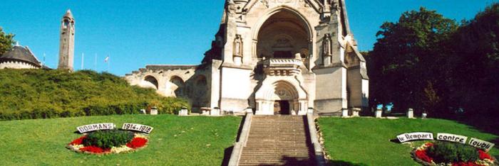
It was from Brest that squadrons departed to support the Americans in the War of Independence.


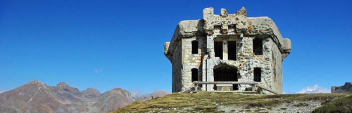
Louis XVI, who wanted to turn the port into an impenetrable fortress, decided to complete Vauban's fortifications with the construction of a line of defence to the west of the town. It consisted of five independent forts.


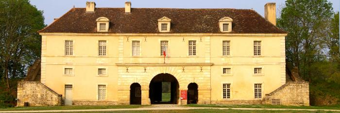
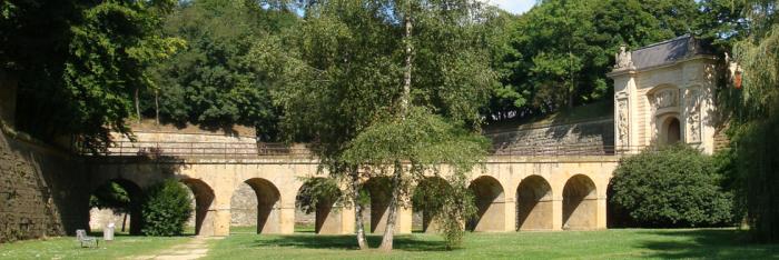
The largest, Fort Montbarey, was designed to withstand a siege lasting three weeks with 500 to 600 soldiers. Its construction lasted from 1777 until 1784.


Completed after the American War of Independence, it only ever had a role as a deterrent.


The French Navy made it available to the Memorial Association in 1984 in order that it could be used to tell the history of Finistère during the Second World War.

The museum occupies some of the 3 hectares and consist of:


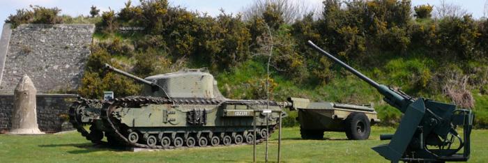
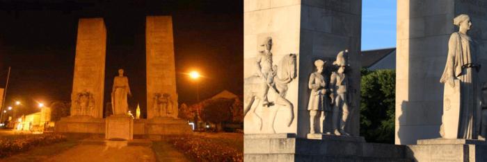
5 main rooms: Cell I : Accommodation for 100 soldiers. Screening room for the video "Brest at war during the Second World War". Cell II : Artillery workshop also used as accommodation for 50 soldiers in the garret. The exhibition "Old boats in the turmoil" recounts the departure of boats to Great Britain following the appeal of 18th June 1940. Cell III: Hall of honour: Maps tracing the development of the conflict of 1933 to 1945. Finistère's decorations and towns awarded medals. Model of the Fort as it was designed. Churchill's tank. Map tracing the American advance on Brest. Crypt of Remembrance. Gallery for the people of Finistère who "died for France" and the Allies who died in battle. Cell IV : Artillery workshop with accommodation for 50 soldiers. Here we find models and vehicles, as well as the "Brest at war" exhibition Cell V: Accommodation for 100 soldiers. Exhibition: the 1st French army and the Provence landings.


Northern Quarter - Pharmacy which also served as accommodation for the surgeons and the chaplain. Along with the infirmary, it houses a 1940 exhibition. - Infirmary. It was the first time that a place for confining the sick and wounded had been incorporated into the design of a fort - Room of the Résistance. - Room of the Deportation. It is important that this is seen by the younger generation, but it is not advised to bring very young children.
Southern Quarter: - Flour store with accommodation for the quartermaster in the garret. During the Second World war it was used as the mess for German officers. It was they who drew the eagle and horses' heads and carved the mottos. Bottom right "Fidelity is the essence of honour". It is a quote from Bismark. On the right as you enter "The struggle leads us to victory". On the left "Germany will live on if we must die". An exhibition covers the involvement of aviators from Finistère in the Free French Forces (FAFL).


- Bake house : the oven designed to bake 300 loaves a day is still in working order. The hook was used to hang the sacks of flour so they could be emptied onto the table. In the wall, a pipe brought the water required for baking.


Exhibitions: "The American War of Independence". "Overseas theatres of operations" (Free French). - Quartermaster's stores. On the right as you enter is the wood store. On the left is the back of the oven. At the end there was a small well from which the water was drawn to feed the waterspout that comes out in the bake house. - Wine store.


Deportation wagon : It was in wagons like this that deportees were taken to the camps; the journey lasted about a fortnight with 100 to 120 or even 150 people inside. It is dedicated to the wartime railwaymen and to Finisterian deportees.

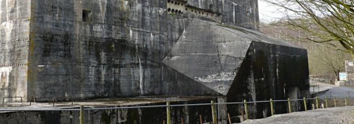
Blockhouse: Constructed in 1953 by the French navy, it housed a Radar command post during the cold war. Room 1: The presence of the Kriegsmarine in Brest, most notably the Scharnhorst, the Gnelsnau and the submarine base.


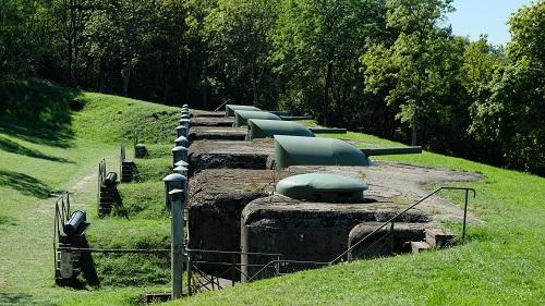
Room 2 : Ammunition found in the area.


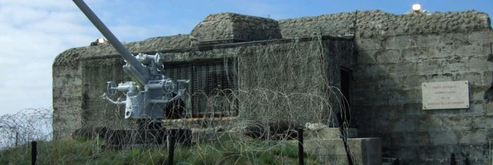
Well : Fed by a spring, it contained 4,000 litres of water. Between the 12th and 16th September 1944, it served as an improvised command post to the soldiers of a battalion of the 2nd Parachute Infantry Regiment who were entrenched in the fort. To liberate the fort, the Americans had to call upon the British who were armed with Churchill Crocodile flamethrower tanks, of which an example from the period can be seen at the entrance to the courtyard.


Vehicles: They are all original. With the exception of the tank they are all in working order. Most of them served during the Normandy landings (a painted star on the vehicle). They are on show at the fort as a tribute to the action of the allies that allowed the liberation of France.


Musée Mémorial des Finistériens

Fort de Montbarey – Allée Bir-Hakeim

BP 53111 - 29231 Brest cedex 3

Tél. : 02 98 05 39 46        @mail : fort.montbarey@free.fr


Visites :

Le mardi, mercredi, jeudi et vendredi de 14h à 17h (jusqu’à 18h en été)

Le dimanche de 14h à 17h (jusqu’à 18h en été)

Groupes (≥ 10 pers.) : visites guidées sur rendez-vous ; autres jours/horaires possibles.


Boutiques (livres, documents sur la Seconde Guerre mondiale).

Parking à l'intérieur du fort pour environ 40 voitures


Tarifs :

Adulte : 5 €

Anciens Combattants (1) : 3 €

Enfants de 9 ans et plus, étudiants (1) : 3 €

Enfants de moins de 9 ans : gratuit

Gratuité pour les personnes adhérant à l’association Mémorial (25 €/an)

Forfait scolaire : 25 € par classe

Tarif pour groupe supérieur à 10 visiteurs avec visite guidée


(1) sur présentation de la carte correspondante


Accès : Rocade Ouest de Brest Prendre la Direction Le Conquet,

dans un grand rond-point, le musée est clairement signalé.


Quizz : Forts et citadelles


> Return to results

Practical information

Address

Fort de Montbarey – Allée Bir-Hakeim - 29231
Brest cedex 3
02 98 05 39 46

Arc de Triomphe

Arc de Triomphe. Photos © Frédéric Prochasson - Fotolia.com

There are as many different viewpoints of the Arc de Triomphe, than there are roads starting from Place Etoile...

Short history of the construction In February 1806, Napoleon I orders the construction of the Arc de Triomphe, in order to commemorate the victories of his armies. Finally the emperor decides to built it in Place de l'Etoile. The first stone of the monument is placed on August 15th 1806. The plans of this construction are those of the architect CHALGRIN. In 1870, in occasion to Napoleon's wedding with the archduchess Marie-Louise of Austria, he will built a trompe-oeuil of wood and painted material. Finished in time for the ceremony, the decoration gives an idea of what the monument will be once completed. CHALGRIN dies in 1810. He is replaced by Louis-Robert GOUST. At the end of the year 1813, the Arc reaches 19 meters height. The events of 1814 questions everything. Under the "Restoration", the works doze. Louis Philippe, who became king in 1830, decides to give life to this project again. The works start again and the Arc de Triomphe, dedicated to the Armies of the Revolution and to the Empire will be completed by the architect Guillaume - Abel BLOUET. The monument will be inaugurated on July 29th 1836.

The Monument The proportion of the Arc de Triomphe are enormous : it measures 49 meters height and exceeds 45 meters width. The arch of the two frontages reaches 20,50 meters of height for a width of 14,50 meters. The transversal frontages are pierced of an arch of 19 meters height on a width of 8,50 meters. The big frieze surrounding the four façades represents the great personalities of the Revolution and the Empire, or furthermore the return of the armies from Italy and Egypt.
The most imposing ornament is without any doubt the one formed by the four colossal groups erected on each pier of the two great façades : - Avenue de Champs Elysées : the Departure of the volunteers (left), still called La Marseillaise, of François RUDE and on the Triumph of the emperor (left) sculpted by Jean-Pierre CORTOT - Avenue de la Grande Armée, the two sculptured alto-rilievo represent the Resistance on the right, and the Peace on the left. On the interior surfaces of the big and small arches, the names of the generals and the great battles of the Revolution and the Empire are engraved. On the ground, near the grave of the unknown soldier, several bronze plaques commemorate important events of the contemporary history : the proclamation of the Republic on September 4th 1870, the return of Alsace-Lorraine to France on November 11th 1918 the call to arms on June 18th 1940. It also evocates the memory to the fighters and the resistant fighters of the Second World war, as well as the memory of "the dead for France" in Algeria, Tunisia and Morocco.
Climbing up the Arc de Triomphe Climbing up the Arc de Triomphe means climbing up 284 steps (an elevator gives access to handicapped persons), but it also means to have access to different museum halls and to the terrace. The big hall of the museum, situated under the terrace, exhibits a vast number of documents : engravings, drawings, photographs, models and various original parts of projects (for example the elephant), the construction and the decoration of the Arch, as well as great events, for example the return of Napoleon's I ashes (the 15th of December 1840),Victor HUGO's dead guard (May 29th 1885), the march of the Victory (on July 14th 1919), the arrival of the unknown soldier (January 28th 1921), the homage to General de Gaulle on the grave of the unknown soldier in a released capital (August 26th 1944). The terrace allows/gives a splendid view of Paris, the Champs Elysées, the Louvre, the Eiffel tower, the Dome des Invalides, and westwards the Arche de la Défense.
The Unknown Soldier The armistice, which puts an end to the First World war, is signed on November 11th 1918 in Rethondes (near Compiègne in Oise). Nevertheless the joy of the victory is plunged into mourning of 1 500 000 victims, for the majority very young. Soon in the small villages as well as in the big cities, monuments in memory of all the dead will be raised and in companies, in high schools and colleges commemorative plaques are carried out. On November 20th 1916, whereas the terrible Verdun battle is in the mind of everyone, F SIMON, President of the French Memory, has the idea to honour a soldier in the Panthéon, who like many others fought and died bravely for his fatherland. The project is finally adopted by the deputies on November 12th 1919. One year after, at the beginning of the month of November, the Parliament decides that the remainders of one of the unidentified soldiers, died during the war on the Field of Honour, will be buried under the Arc de Triomphe. Eight bodies of unidentified French soldiers, chosen among the different front sectors, are then transported in the Verdun citadel. November 10th 1920 at 3 p.m. the soldier Auguste THIN, son of a fighter, who died himself in the war, indicates by depositing a bunch of flowers on one of the coffins which will be carried to Paris. On November 1920, in the morning, after a ceremony at the Panthéon, the coffin is deposited in one of the halls of the Arc de Triomphe, arranged in a chapel of rest. On January 28th 1921, the coffin of the Unknown Soldier is buried in the centre of the principal arch, facing the Champs Elysées.
The Symbol of the flame Following the suggestion made early in 1921 by sculptor Gregory Calvet, then in October 1923 by the writer Gabriel BOISSY, the sacred flame under the Arc de Triomphe was lit for the first time November 11, 1923 to 18 hours by Andre Maginot, minister of war, while troops of the 5th RI presented arms as the band played Chopin's Funeral March." Since that date the flame was never extinct. Every evening at 6:30 p.m. the flame is revived by the representatives of the Association of Veterans or associations, whose good citizenship is recognized (such as the Red Cross). This ceremonial never stopped, not even during the occupation between 1940 and 1944. Obviously the Parisian high-school pupil and student, turn toward the flame and the tomb of the Unknown Soldier, during the processions defying the occupant. The Flame under the Arc de Triomphe evokes also for some people the Flame of the Resistance, of which a certain Charles de Gaulle once used to talk. Nowadays, the Tomb of the Unknown Soldier and the Flame of Memory symbolize for all the French, but also for the tourists of the entire world, the sacrifice of all those who died on the battlefield. The Flame of Memory also symbolizes the tribute paid to those who gave their lifes, to make us live in a free country. Lastly, since the tragic days of the occupation, the symbol of the flame found an additional vocation, the one of hope in the future and faith in the destiny of our country.
The ceremony of the revival Since November 11th 1923, each evening at 6:30 p.m. the flame is revived by the representatives of the Association, following a planning established by the Committee of the Flame. A precise ceremonial takes place. Each day, at least two members of the Committee, are appointed to accommodate the Associations and organise the ceremony. The associations meet either at the crossroad Champs Elysées/ Balsac, or at the top of the Champs Elysées, or directly at the Arc the Triomphe, when the participants are not too many. They are then taken under the Arc de Triomphe. At the top, the flower carriers lead the procession, followed by flag holders and the members of the association. They reach their final destination by taking the principal alley of the Champs Elysées. The participants take position on both sides of the Holy Flagstone and the flag holders take place in a circle on the west side of the flagstone. Before the ceremony the Commissioner and the Service Guard set up the flag of "the Flame", the bugle and the drum of the Republican Guard. Lastly the Commissioner of the flame and the different Presidents of the Associations join the Flagstone, they ascent the alley accompanied by the the call "The Flame". he delegations are then invited to lay their wreath, then while placing themselves near the flame, the Commissioner gives the sword to the president, who is invited to make the gesture of the revival. The call "To the Deaths" resounds, the flags are inclined, followed by a minute of silence. When a military melody (or other) is played, the call "to the Death" is followed by the refrain of the Marseillaise. The president is accompanied by the authorities and together they sign the Golden Book, then of a fraternal gesture they greet the flag holders, the Commissioners of the Flame, the members of the Associations and the guests aligned along the Flagstone. Everybody unite at the foot of the tomb and the musicians play the anthem "Honour of the Unknown Soldier". Then they are accompanied by the Commissioner in service, whereas the music plays "the Flame". This ritual is the same even when the General, President of "the Flame under the Arc de Triomphe" is present. The delegations are then invited to sign the Golden Book.
Arc de Triomphe Place de l'étoile 75008 Paris Acces Métro Charles de Gaulle-Etoile (1, 2, 6) RER A Charles de Gaulle-Etoile

> Return to results

Practical information

Address

place de l'étoile 75008
Paris
01 55 37 73 77

Prices

Plein tarif : 9,50 € Tarif réduit : 6 € Groupe adultes : 7,50 € (à partir de 20 personnes) Groupes scolaires : 30 € (20 € pour les ZEP) ; 35 élèves maximum. Gratuit : Moins de 18 ans (en famille et hors groupes scolaires) 18-25 ans (ressortissants des 27 pays de l’Union Européenne et résidents réguliers non-européens sur le territoire français) Personne handicapée et son accompagnateur Demandeur d’emploi

Weekly opening hours

Du 1er avril au 30 septembre, 10h à 23h Du 1er octobre au 31 mars, 10h à 22h30

Fermetures annuelles

1er janvier, 1er mai, 8 mai (matin), 14 juillet (matin), 11 novembre (matin), 25 décembre

Fort de Mutzig

©Association Fort de Mutzig

Construit de 1893 à 1918 sur ordre de Guillaume II, empereur d’Allemagne, la Feste Kaiser Wilhelm II, «Fort de Mutzig», est la première fortification allemande bétonnée, cuirassée et électrifiée. Elle est en 1914 avec ses 22 tourelles d’artillerie et sa garnison de 7 000 hommes la plus puissante fortification en Europe. Elle constitue aujourd’hui un pôle touristique de tout premier plan en Alsace.

La mission de la Feste Kaiser Wilhelm II construite de 1893 à 1916 consistait à empêcher toute offensive française par la plaine du Rhin sur les arrières des forces engagées en Belgique. Elle est la première construction fortifiée après l’invention de la mélinite, explosif capable de détruire les structures maçonnées traditionnelles des forts.

  • Une révolution technologique :

Les ingénieurs allemands vont construire à Mutzig les premiers ouvrages intégrant de nouvelles technologies et de nouveaux concepts qui vont révolutionner la fortification :

Le béton : Premier ouvrage entièrement bétonné.
Le cuirassement : Première fortification cuirassée.
L’électricité : Premier fort doté d’une centrale électrique destinée à produire le courant pour la ventilation, l’éclairage, les pompes, etc.
La fortification éclatée : Première fortification éclatée appelée « Feste », architecture inventée et mise au point vers 1897 au Fort de Mutzig.

  • Une fortification expérimentale :

Le fort de Mutzig est caractérisé par la très grande diversité des différents ouvrages réalisés, prototypes, versions expérimentales, équipements en cours de test, etc.

La liste des ouvrages et équipements installés pour la première fois dans une fortification est éloquente : au moins 3 générations d’abris d’infanterie, 3 types de batteries, 3 modèles d’observatoires cuirassés, 2 types de périscopes.

Le Fort de Mutzig occupe une surface de 254 Ha, 40 000 m² souterrain pouvant accueillir près de 7000 hommes, il est doté de 22 tourelles pour des canons de 10 cm et de 15 cm avec une puissance feu de plus de 6,5 tonnes d’obus à la minute.

  • Une fortification efficace :

Par sa simple présence, la Feste Kaiser Wilhelm II a empêché toute opération militaire d’envergure dans la vallée du Rhin. Elle démontrera son efficacité le 18 août 1914 par un tir de 291 obus. Elle passera, intacte, sous la responsabilité de l’armée française qui la maintiendra pour finalement lui assigner le rôle de PC arrière de la défense du Rhin en 1939. En juin 1940, le fort est évacué par les troupes françaises et réoccupé sans combat, mais avec un bombardement des troupes allemandes par la Luftwaffe qui causera perte de plus de 80 soldats. Enfin, la petite garnison résiduelle chargé de défendre le fort en novembre 1944 se rendra finalement le 5 décembre 1944 à court de vivres et de munitions.

  • Un site d’histoire et un lieu touristique majeur

La partie aujourd’hui ouverte à la visite du Fort de Mutzig expose l’ensemble des équipements d’origine restauré ou mis en valeur avec des panneaux explicatifs, des maquettes et de nombreux objets d’origines. Les visites donnent une vision synthétique du contexte géopolitique et stratégique de l’Europe ainsi que de la révolution technique et industrielle. Nous proposons à nos visiteurs de redécouvrir notre histoire avec une perspective d’européen, sans a priori, les histoires nationales n’étant que des éléments d’une histoire européenne.


Quiz : Forts et citadelles


> Return to results

Practical information

Address

Rue du Camp 67190
Dinsheim-sur-Bruche
06 08 84 17 42

Prices

Groupes scolaires = élèves, étudiants : 7 €, gratuité pour les encadrants - Groupes adultes : 14 € / Visite libre = Adultes : 12 €, jeunes de 6 à 16 ans : 7 €, moins de 6 ans : gratuit

Weekly opening hours

Horaires variables selon la saison, consulter le site Internet. Les horaires des visites guidées sont fixés d’un commun accord.

Site Web : www.fort-mutzig.eu

The Monument National de la Gendarmerie

Vue de nuit. © J.-P. Le Padellec - Détails © C. Caudron

In 1935, military members of the gendarme movement and public figures came together to study and propose plans to commission a monument to pay homage to and commemorate the history of the movement.

In 1935, military members of the gendarme movement and public figures came together to study and propose plans to commission a monument. After gathering the required funds and obtaining free land in the commune of Versailles, a competition was held to determine the design of the monument and was won by Mr. Charles Nicod and Mr. Robert Auzelle. The monument, which was built by Mr. Rispal, was completed in November 1941; however, due to circumstances it was not officially inaugurated until 1946.

The monument erected in Versailles in honour of the gendarmerie was recently completed. It consists of a majestic central statue flanked by two massive pylons, 12 metres high and 3 metres wide, some distance from the statue so as to not block the view of the façade of Saint Antoine de Padoue church, which dominates the horizon. Around the pylons are groups of sculptures that have been harmoniously arranged and which provide a brief history of the gendarme movement. The magnificent four-metre high statue symbolises the force at the service of the Law. The statue's right hand leans on a shield, which symbolises the protection that the Gendarmerie offers the country and its citizens in serving the interests of Order and Justice. The other arm is making a powerful gesture, symbolising the energy with which the courageous soldiers of the elite armed forces carry out their mission. Each group of sculptures represents modern-day gendarmes, accompanied by their military ancestors who have played a role in other events in French history: Louis XV, The French Revolution, the First Empire, the conquest of Algeria, the Great War, tanks, gendarmes and modern-day guards. On the left, there is a statue of a gendarme on horseback, dated 1880, while to the right there is a statue of a Republican guard, also on horseback, dated 1936.
The uniforms have been recreated in extremely accurate detail and inspired by uniforms from the military museum and by information supplied by the head of the Bucquoy Company, a PhD in social sciences, the director of the magazine "Le Passepoil" and an expert in European military uniforms. At the foot of the statue, a hypogeum crowned with a bronze shield holds the ashes of Le Gallois de Fougières, the provost marshal of France killed in the battle of Azincourt (or Agincourt) in 1415 and buried close to the scene of the battle on the grounds of the Auchy-Ies-Hesdin church (Pas-de-Calais).
The monument is located in Versailles Saint-Antoine junction At the end of Boulevard du Roi

> Return to results

Practical information

Address

Place de la loi 78000
Versailles

Weekly opening hours

Accessible toute l'année

Fort Médoc

Fort Médoc. Photo : ©hubert sion. Source : http://www.tourisme-gironde.fr/

Built at the request of Louis XIV in 1689, Fort Médoc has the classic appearance of a Vauban-style fortification, with its grassed ramparts, moats and large open spaces...

The decision to build Fort Médoc was made by Louis XIV in 1689. The construction work that had started in 1690 was far enough advanced in 1691 to allow a first garrison to move in, even before the fort was finished. Fort Médoc has the classic appearance of a Vauban-style fortification, with its grassed ramparts, moats and large open spaces leading up to the fort. Basically rectangular in shape, it is flanked on its four corners by bastions linked by curtain walls. The moats communicate with the Gironde by a system of locks that allow the water level to be maintained regardless of the tide.

After crossing the royal demi-lune in front of the buildings and the moats, visitors reach the heart of the fort by the Porte Royale, whose pediment is decorated with a sun, the emblem of Louis XIV. The vaulted corridor beneath the central building was sealed by a wooden lattice-work gate and by a portcullis, which has since disappeared. Lateral casemates with arrow loops provide security for the passage. The central building, the royal guard house, originally accommodated the garrison's commanding officer on the first floor and consisted of weapons storage rooms on the ground floor and fine vaulted rooms in the basement.
The enormous interior esplanade was bordered by two barracks on a single level, capable of accommodating up to three hundred men. These buildings never held more than around a hundred people and the only things that remain today are the floors, a few sections of wall and a fireplace. The guard house overlooking the bastions, the fresh water tank, the chapel and the powder store are, however, still there to be admired. From 1700 onwards, the defensive purpose of this fort, which was deemed to be barely operational, was questioned by military engineers and later by the bursar, Tourny: the earth supporting the bastions and curtain walls proved to be too weak to prop up the fort's defences, the marshland around the site led to several epidemics amongst the company, who had to be relieved too frequently and, most importantly, it was easier for ships to take the Blaye channel than the shallower Médoc channel.
Playing only a negligible role in the defence of the Gironde estuary, Fort Médoc was never to be tested under fire. A garrison was stationed there until 1916 and in 1930 it became the property of the Cussac-Fort-Médoc local authority. Today the town council manages the site in conjunction with the association of the friends of Fort Médoc. The fort is currently the subject of an ambitious renovation programme and has for many years hosted various cultural events in the summer season.
Tours The fort is open for tours every day in the summer season. More information from the mairie of Cussac-Fort-Médoc Access 40 km from Bordeaux via Blanquefort and Margaux, on the D 2. Mairie of Cussac-Fort-Médoc 34 Avenue du Haut-Médoc 33640 Cussac-Fort-Médoc tel. + 33 (0) 5 57 88 85 00 fax. + 33 (0) 5 57 88 85 15

> Return to results

Practical information

Address

Avenue du fort Médoc 33640
Cussac-Fort-Médoc

Weekly opening hours

Ouvert à la visite tous les jours en saison

Memorial to the Battles of the Marne, Dormans

Memorial to the Battles of the Marne. Source : GNU Free Documentation License


Built between 1921 and 1931, the Dormans Memorial commemorates the victories won in the Marne between 1914 and 1918.  


The Memorial is situated on the left bank of the Marne on a hill overlooking the river and the town of Dormans. When the plan to erect a large monument to remember all of the battles in Marne was confirmed, this site was chosen by Marshal Foch as a place that represented both battles. The building was made possible thanks to an association founded by Madame de la Rochefoucauld in 1919, overseen by the Cardinal of Reims and the Bishop of Châlons. A vast park with a chateau was purchased, and the first brick was laid on 18 July 1920. The building work, which took 10 years from 1921 to 1931, was funded by numerous donations, in particular those collected by the ‘national subscription’ in 1929 dubbed "four monuments day” (the association which became a charity, was recognised as a public interest organisation by presidential decree on 20 May 1932).


The impressive ensemble was designed by architects Marcel and Closson. A monumental staircase leads to a large square with a sundial and a viewpoint indicator that shows the names of the villages in the Marne Valley where the Battle of 1918 was fought. The square itself leads to a crypt that is overlooked by the church that boasts a bell tower and two ridge towers.


The inside of the chapel is entirely dedicated to the glory of the “soldiers, the army and the fatherland".


The stained-glass window in the choir represents Christ welcoming a soldier to symbolise all those who died during the Great War, presented to him by Joan of Arc and St Michael. On each side, angels intercede in his favour.

The stained-glass windows at the sides of the transept (by the renowned Lorin firm in Chartres) represent the patron saints of the different branches of the army.


The four columns standing on the crypt’s vaulted bases are decorated with sculptures depicting the four great invasions of France by the Huns, the Arabs, the English and the Germans, which were all contained (the Catalunian Plains in 451, Poitiers in 732, Orleans in 1429 and Dormans 1914-1918).


The 52-metre tower houses several bells, the largest weighing 304 kg. Beside the chapel is a cloister. Rather austere in appearance with its pointed arch, from the side it is attached to a funerary building housing the ossuary, close to a lantern tower for the dead. At its entrance, a medallion features the effigies of marshals Foch and Joffree, the two victors of the battles of the Marne, while the names of all the soldiers who fought in the battles are engraved in the wall plaques.


Inside the ossuary, the mortal remains of 1,332 French soldiers who fell between 1914 and 1918 are held in 130 coffins; only 11 of these men were identified. The funerary chamber also holds two urns: the first one contains earth taken from the cemetery in Italy where soldiers of the Free French Forces killed during the battles in 1943-1944 in Monte Cassino are buried; the other holds the ashes of deportees returned from Dachau in 1948.


Every year since 1993, during the Armistice commemorations, an official ceremony is held in the ossuary where a wreath given by the French President is laid by a delegate Senior Officer from the Elysée Palace.


Opening times

From 1 April to 11 November every day from 2-6 pm and Sundays from 10 am to 12 pm and 2-6 pm.


Contact

Dormans Tourist Information Office, Château de Dormans - 51700 DORMANS
Tel: +33 (0)3 26 53 35 86

Memorial secretariat: +33 (0)3 26 57 77 87

Memorial: +33 (0)3 26 59 14 18


Site du 90e anniversaire des batailles de la Marne


Office de tourisme de Dormans 


Source: MINDEF/SGA/DMPA - Vincent Konsler

> Return to results

Practical information

Address

avenue des victoires 51700
Dormans
03.26.59.14.18

Prices

Guided tour: €2. Independent tour, free admission.

Weekly opening hours

From 1 April to 11 November, every afternoon from 2.30 to 6 pm; Sundays 10 am to 12 pm.

Fermetures annuelles

Closed December to March